This is a work-in-progress.
What: I’m compiling a mix of hand-curated and openly licensed (CC-BY, Public Domain, or equivalent) data for protected areas around the globe. These areas include places like National Parks, Wildlife Reserves, Nature Reserves, Marine Protected Areas, and other places with similar designations. This data will eventually be released somewhere, with:
- a clearly defined CC-BY license
- a standardized set of attributes
- global coverage
- ???
I’ve compiled and standardized data for the following so far:
- Afghanistan
- Åland Islands
- Albania
- American Samoa
- Andorra
- Angola
- Armenia
- Australia
- Austria
- Belgium
- Bosnia and Herzegovina
- Bulgaria
- Chile
- Croatia
- Cyprus
- Czechia
- Denmark
- Estonia
- Finland
- France
- French Guiana
- French Southern Territories
- Germany
- Greece
- Greenland
- Guam
- Hungary
- Iceland
- Ireland
- Italy
- Kosovo
- Latvia
- Liechtenstein
- Lithuania
- Luxembourg
- Malta
- Montenegro
- Nepal
- Netherlands
- New Zealand
- North Macedonia
- Northern Mariana Islands
- Norway
- Poland
- Portugal
- Puerto Rico
- Romania
- Serbia
- Slovakia
- Slovenia
- Spain
- Sweden
- Switzerland
- U.S. Virgin Islands
- United States
Though there is still some work to do to understand what constitutes a “protected area.”
Some datasets, like the United States’ PADUS database use a broad definition that includes things like private easements, military facilities, and places with “unknown” designations. Other datasets and data providers have stricter definitions that only categorize national lands.
In 1994, the International Union for Conservation of Nature defined a protected area as “an area of land and/or sea especially dedicated to the protection and maintenance of biological diversity, and of natural and associated cultural resources, and managed through legal or other effective means”. This definition mostly fits the types of places I’d like to compile, with a few caveats.
Ideally, each protected area would be represented in a single feature. Though sometimes a protected area can encompass another one, or groupings of protected areas can be parented by a single, larger protected area (ex: Maloti-Drakensberg Park).. still unsure how places like this will be represented.
At minimum, each place should have an id, name, type, iso country code, source information, note and geometry. Many will have establishment dates, localized names, local language codes, and source concordances.
Why: Well, similar datasets have already been published.. but I’m trying to solve three problems:
- None of these datasets contain global coverage under an open license.
- Many of these datasets are out of date.
- Many of these datasets are inaccurate or incomplete.
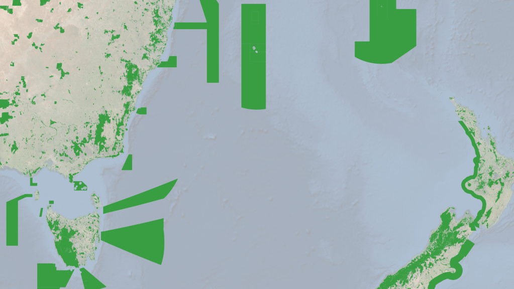
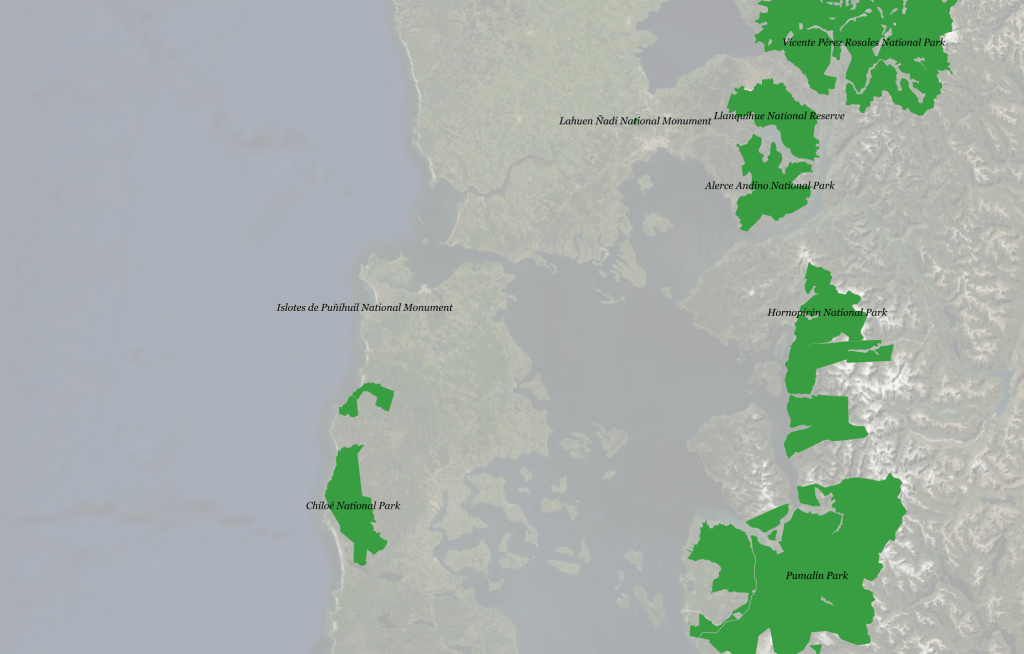
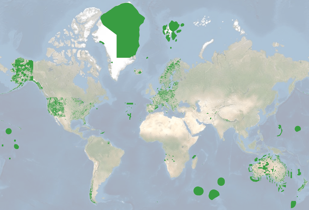
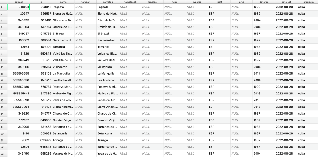
Here are some screenshots, more info to come soon (hopefully):

Leave a comment