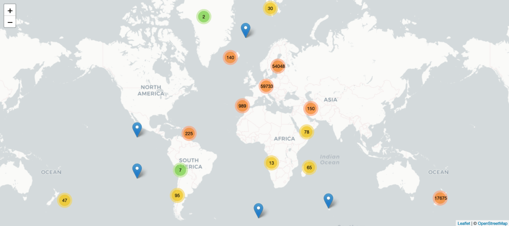
After wrapping up the 50th (!) Protected Areas Data dataset, I thought it would be helpful to have a single, centralized home for the project. I figured a simple leaflet map that contains the locations of each protected area, a blurb about what I’m trying to do with the project, and info about where data can be found would be a good start.
The project still doesn’t feel like it’s close to a v1 yet, but at least this would be a start. Presenting: Protected Areas Data + Leaflet.
https://stepps00.github.io/Protected-Areas-Data/
While the Protected Areas Data datasets live in per-country repositories (list of them here) on GitHub, I decided to spin up a “main” Protected-Areas-Data repository on GitHub, too, as a centralized space for the project. I have no idea if this will be feasible long term, but it’s a step in the right direction.
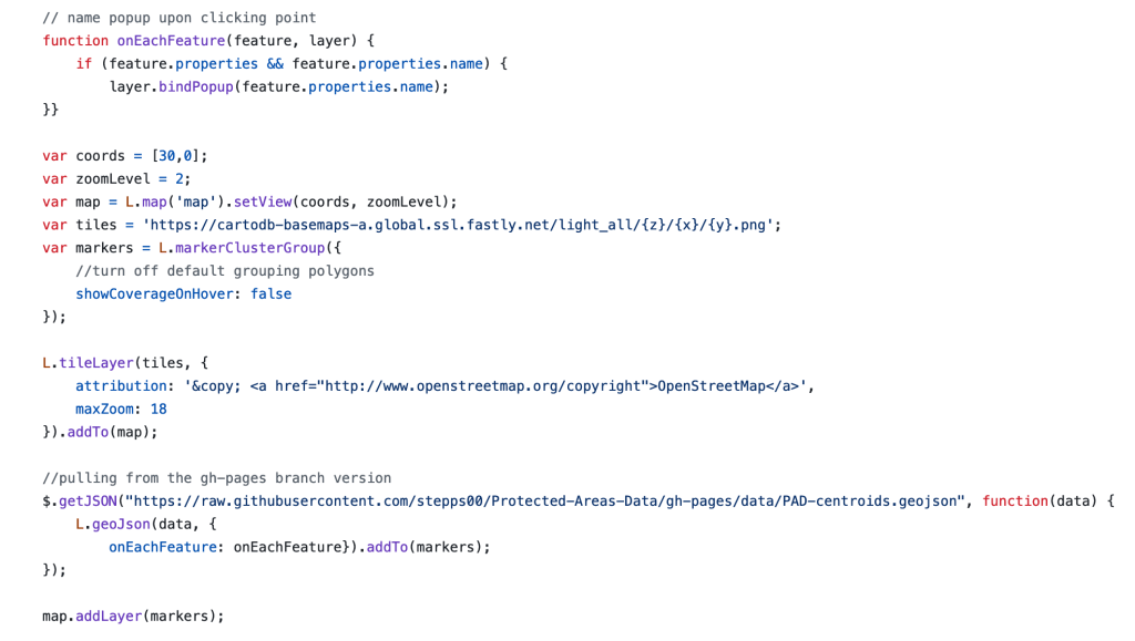
Using a gh-pages branch in that repo, I was able to create an index.html file that contains a Leaflet map. A couple dozen lines of javascript later, and this Leaflet map is able to pull in cartodb basemap tiles (which look awesome, btw), a GeoJSON file of centroids for all protected areas, group the map markers, and show names of each protected area when clicking each marker.
The Leaflet documentation is fantastic, which helped tremendously during this process.
Overall, a little convoluted and confusing, I’m sure… but my hope is that this work can be replicated in each per-country repository and expanded on.
