May 2024: progress on gathering and standardizing geospatial data of protected areas continues...
Since my last update in July 2023, I’ve published protected areas data for several dozens of countries. The majority of these datasets were created using a single CDDA dataset maintained by the European Environment Agency, which was fairly easy to work with. I’ve also created free-hand datasets and combined datasets for several non-European countries. A full list of those datasets can be found here.
Recent publications
- Protected-Areas-Data-Angola
- Protected-Areas-Data-Armenia
- Protected-Areas-Data-Aruba
- Protected-Areas-Data-Bhutan
- Protected-Areas-Data-Chile
- Protected-Areas-Data-Djibouti
- Protected-Areas-Data-Nepal
- Protected-Areas-Data-New-Zealand
- Protected-Areas-Data-Tanzania
- Protected-Areas-Data-United-Arab-Emirates
Both Chile and New Zealand have national mapping agencies that release openly-licensed data on protected areas in their respective countries, so I relied on those to help create the shapefiles for Chile and New Zealand.
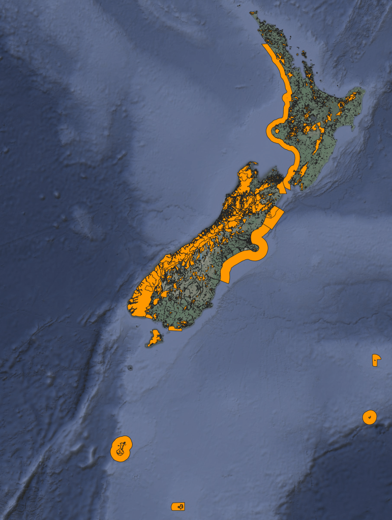
Protected Areas of New Zealand
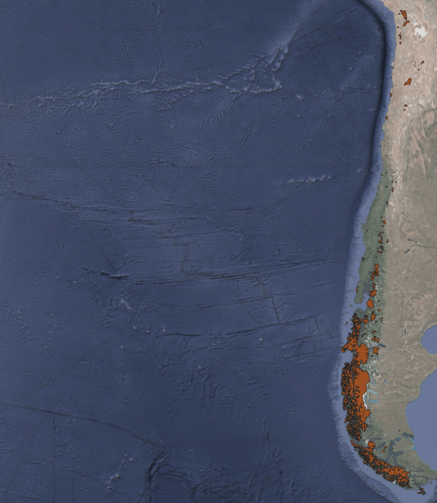
Protected Areas of Chile
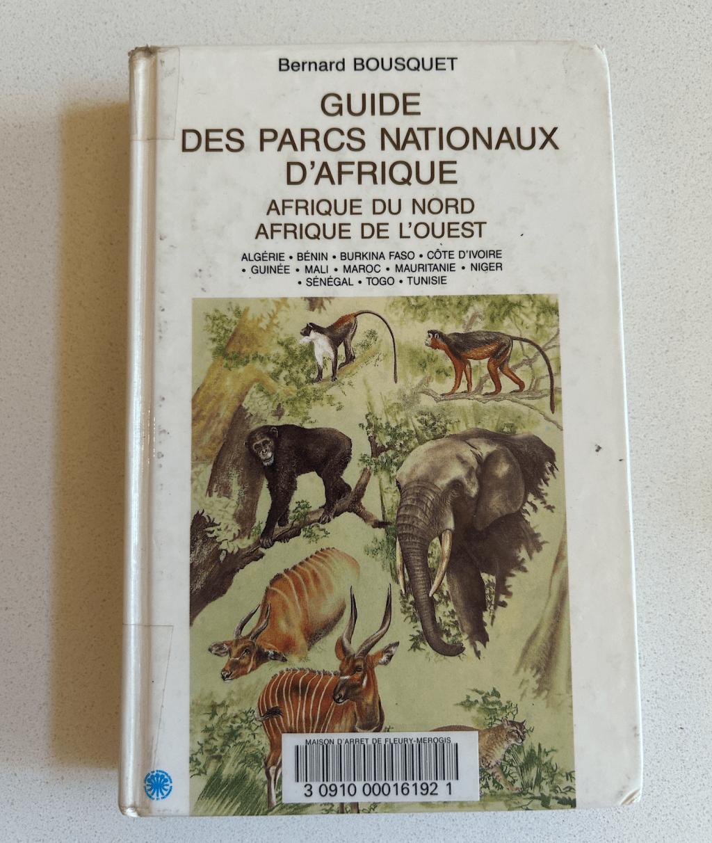
Though most of these datasets were created by digitizing polygons free-hand in QGIS, cross-referencing with various PDF maps, UN publications, national mapping agency files, and open source imagery. Information about protected areas in Algeria was tricky to source and each reference I found seemed to list differing details about the status of national parks. I ended up purchasing a French hardcover book, Guide des Parcs Nationaux D’Afrique, to help the digitizing (and name attribution) efforts.
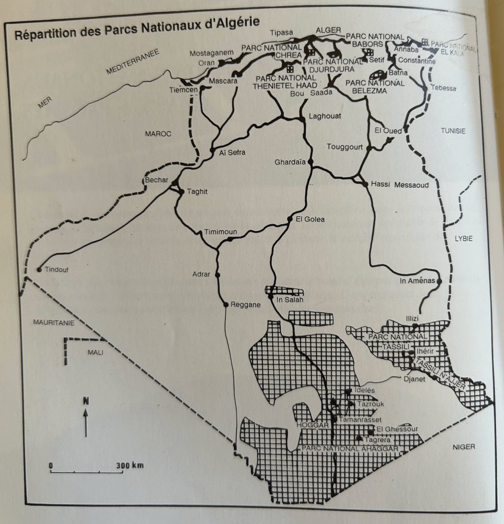
Map of Algeria’s National Park System
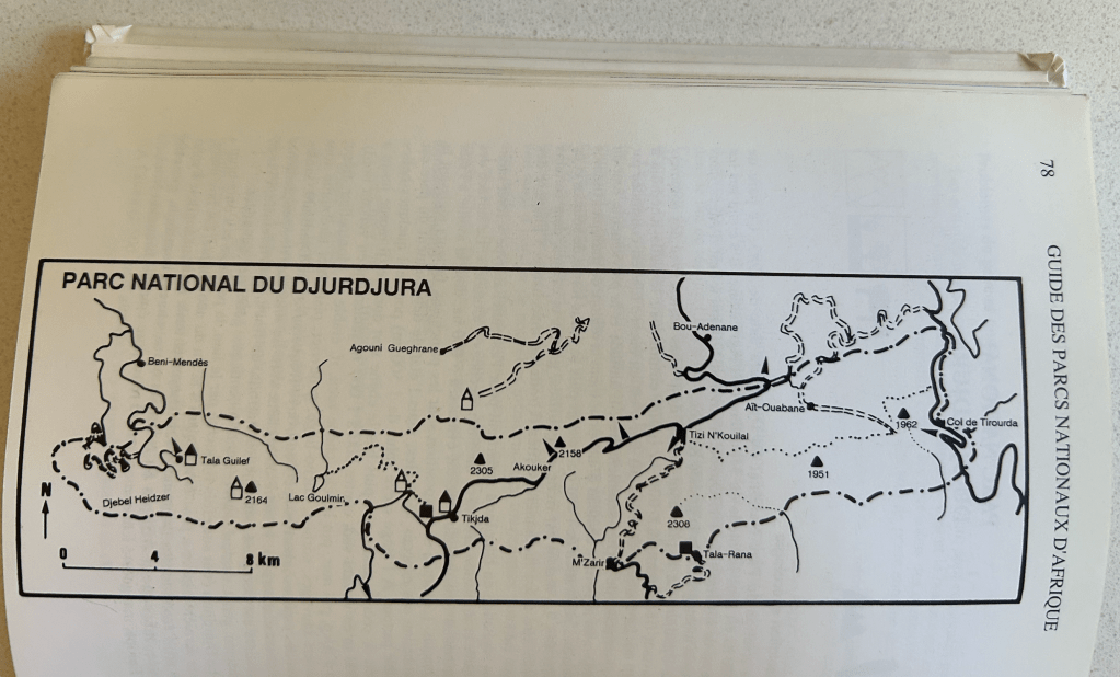
Map of Djurdjura National Park, Algeria
Not perfect, but at least the book was helpful in determining the extent of the southern park boundaries. I’m guessing I’ll use the book for other North African countries, too.
As for Europe..
The CDDA database is a mashup of various national and sub-national protected areas datasets within the EU. It’s a fantastic resource to quickly gather protected areas data for each country, but the attributes did need to be massaged a bit before standardizing them in the schema I’m using for the Protected-Areas-Data-* publications. Some issues I needed to work through:
- Invalid geometries
- Duplicate features
- Non-standardized name attributes
- ALL CAPS and all lowercase attribute values
- Properly handling / removing features in overseas dependencies
- Bunk character encoding
In practice, these issues didn’t take more than a day to untangle and fix.
Next Up
I’ve sourced protected areas data for the United States, Japan, and Mexico, but haven’t yet reviewed the files and standardized the attributes/geometries for release. I’ve also chatted with folks at RAMSAR about use of their data – this is proving to be tricky since they do not release their geospatial data under a specific license (and don’t intend to do so any time soon). So, we’ll see…
I’m also working down the list of countries alphabetically, with WMS layers for Argentina currently loaded up in QGIS.
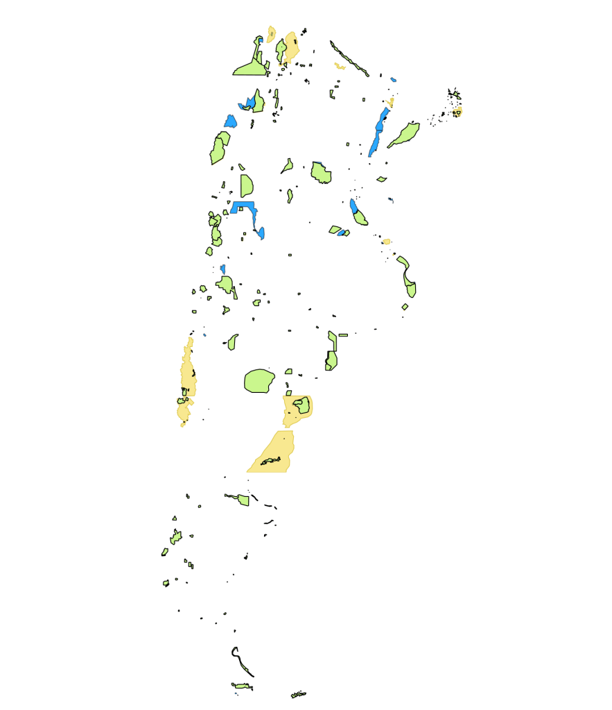
Visualizing Protected Areas of Argentina in QGIS
I’m shooting for a late-May release of Argentina and the United States. Stay tuned!

Leave a comment